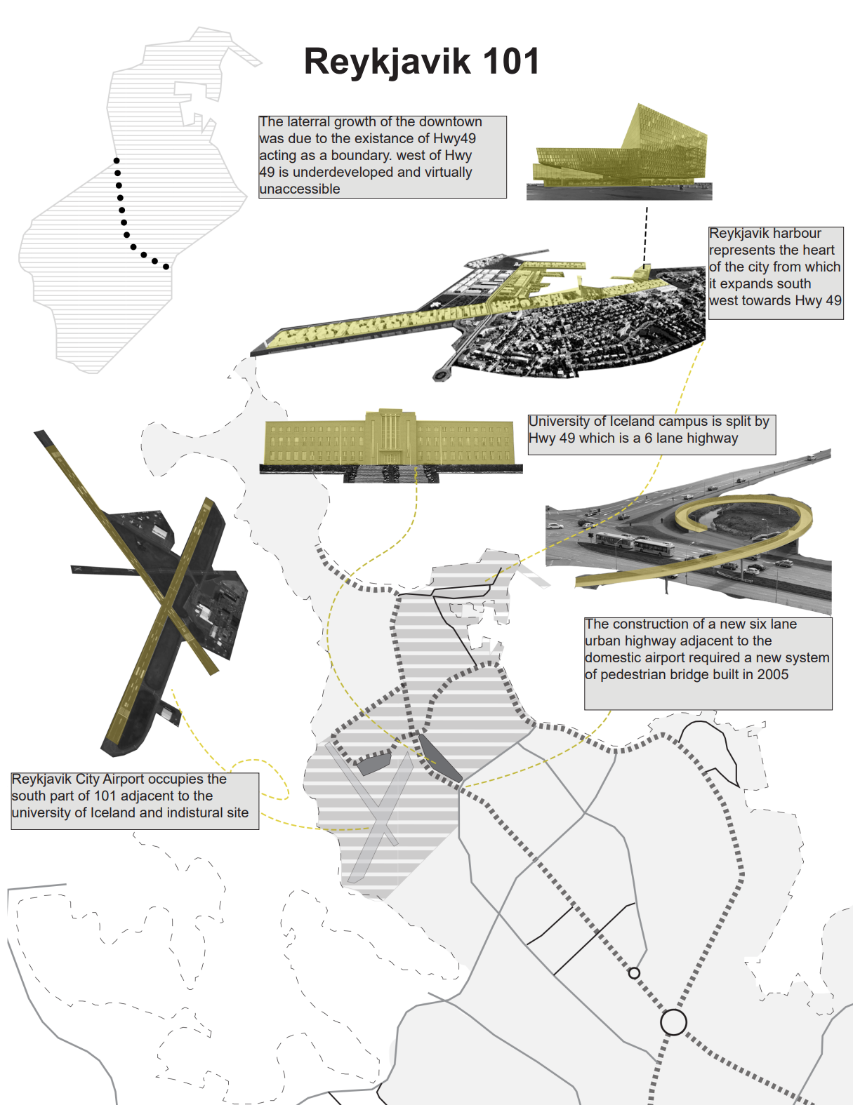
London 2022, Norman Foster Future Cities Seminar
As Reykjavik is a harbor city, the downtown core begins at the water's edge to the south. Observing the city center and landmark distribution in precinct 101, the downtown area extends horizontally across the city, running parallel to the harbor from west to east. A strategy for maintaining close proximity to the harbor has been developed for the city center. However, in the southern part of Reykjavik 101, growth has been slower due to the virtual separation caused by Highway 49, a six-lane highway running across precinct 101, connecting the eastern and western parts of greater Reykjavik. To address this separation, in 2005, the city commissioned the construction of five bridges to connect the university campus on the northern side of the highway.
Demographically, the impact of this virtual barrier is evident in the population growth of different precincts. While Reykjavik 101 has reached a stage of slow growth typically marked by urban saturation, vacant land for development is still noticeable in the southern part of 101. From 1975 to 2015, precinct 101 experienced a 29.2% growth, but over the last 15 years, it has only grown by 7.2%. This decline in demographic growth is mirrored in precinct 104, where growth accelerated from 1975 to 2015 by 21.1%, with one-third of this growth occurring in the last 15 years, resulting in a 7.5% increase.
In 2006, the Icelandic government initiated a competition to divide precinct 101 along the edge of Highway 49, creating precinct 102 as a new urban center. However, this idea did not materialize until 2019 when the government announced the development of precinct 102 as a technology-focused urban center centered around the campuses of two universities and new housing plans.
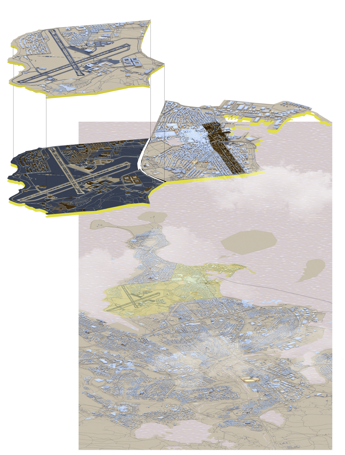
The current city center in 101 primarily accommodates industries and services, such as office jobs and industrial and shipping activities. Further examination of the industrial zone revealed that it was saturated, facing the water and unable to expand due to its proximity to the already developed downtown area. Consequently, the industrial park expanded to a new location east of the city. Most significant civic service buildings are situated within or near precincts 101 and the future 102. Given the virtual barrier posed by Highway 49, which prevents southward expansion and connection to the southern part of the city, an economic analysis considered projected sea level rise for Reykjavik, as this issue is increasingly becoming a reality that must be addressed. The map illustrates the projected sea level rise for the year 2100 and the affected areas. Notably, downtown precinct 101 is at the forefront and would be the first to be impacted if this projection materializes.
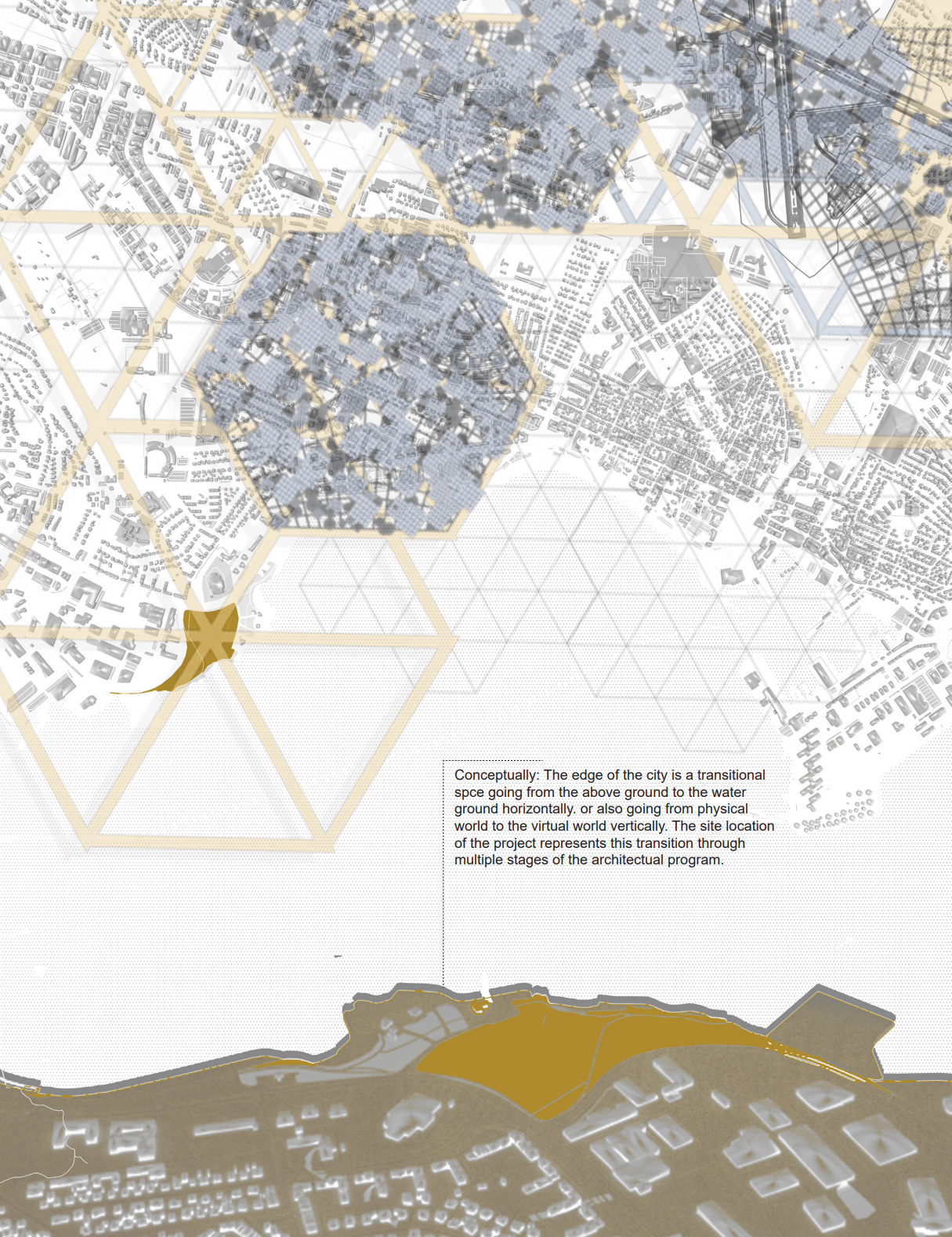
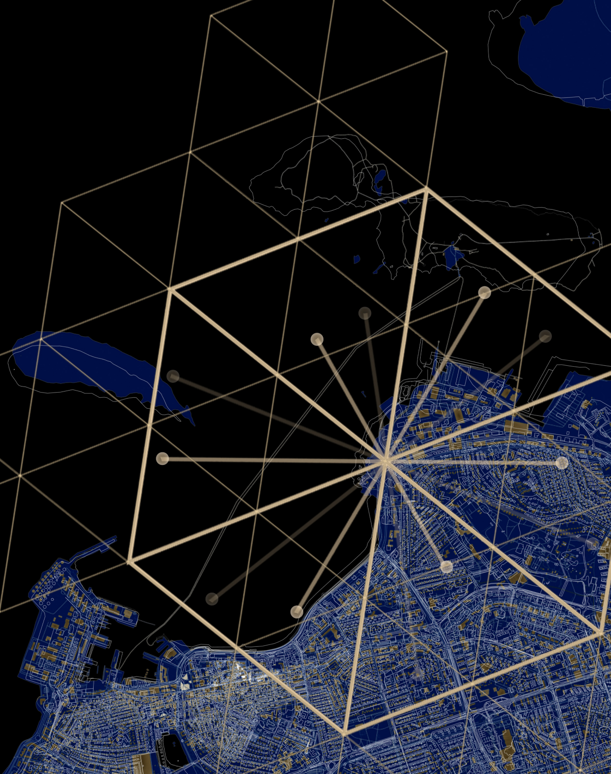
To further explore the conception of precinct 102, Walter Christaller's central place theory was applied to Reykjavik. This theory in urban geography aims to explain the distribution patterns, sizes, and numbers of cities and towns. It also provides a framework for studying the locational patterns of areas in a commercial or residential system. Christaller's theory relies on simplifying assumptions, including an isotropic, homogeneous, limitless surface, an evenly distributed population, settlements arranged in a triangular lattice pattern, and evenly distributed resources. The theory introduces two key concepts: threshold, representing the minimum market (population or income) required for selling a particular good or service, and range, signifying the maximum distance consumers are willing to travel to obtain goods before costs or inconvenience outweigh the need for the good. Given the small size of the city and the proximity theory, precinct 102 becomes a conceivable concept, as its services would be accessible once it develops a city core.
RVK 102